
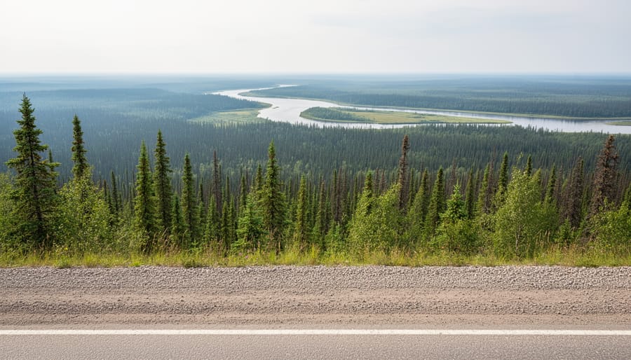
Fort Smith serves as the primary gateway to Wood Buffalo National Park, Canada’s largest national park and a UNESCO World Heritage Site spanning 44,807 square kilometers of boreal wilderness. If you’re planning a visit in 2026, you’ll want to start at the Fort Smith Visitor Centre and Main Office at 149 MacDougal Road, where Parks Canada staff can provide current trail conditions, maps, and insider knowledge about accessing this remote landscape. The park offers year-round road access from town, making Fort Smith one of the few entry points to explore massive bison herds, the world’s largest inland delta, and some of North America’s most pristine boreal forest.
During summer months, the visitor centre operates seven days a week from 9:00 AM to 6:00 PM, offering not just Parks Canada information but also a local giftshop, exhibits showcasing regional offerings, clean bathrooms, and a water fill-up station before you venture into areas with limited services. This shared space between the Town of Fort Smith and Parks Canada reflects the close relationship locals have with the park, where residents often serve as your best source of trail beta and wildlife sighting tips. Keep in mind that fire-related closures from the 2023 blazes remain in effect in certain areas due to ongoing hazards, so checking in at the visitor centre before your trip isn’t just recommended but essential for safety and trip planning.
Why Visit Wood Buffalo National Park from Fort Smith
What Makes Wood Buffalo National Park Worth the Journey
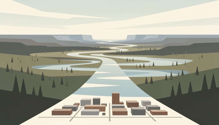
Wood Buffalo stretches across 44,807 square kilometres, genuinely larger than Switzerland, making it the largest national park in Canada and one of the biggest protected wilderness areas on Earth. That scale alone sets it apart, but what earns it UNESCO recognition as a Wood Buffalo World Heritage Site is the extraordinary landscape and wildlife concentrated within those boundaries.
You’ll find ecosystems here that exist almost nowhere else: the sprawling Salt Plains, where ancient seabeds stretch white to the horizon; the Peace-Athabasca Delta, the world’s largest boreal inland delta and a critical stopover for migratory birds; and boreal forests sheltering Canada’s only free-roaming wood bison herds. This is also the only known nesting site for wild whooping cranes, North America’s tallest bird and among its rarest.
The biodiversity draws researchers and wildlife watchers from around the globe. On any given visit, you might spot bison crossing the road at dawn, black bears foraging in berry patches, or pelicans wheeling over delta channels. It’s raw, immense, and utterly unlike the manicured park experience most visitors expect, which is exactly the point.
Fort Smith’s Advantage as Your Base
Fort Smith isn’t just close to Wood Buffalo National Park, it’s the only community offering full visitor infrastructure and year-round road access to Canada’s largest national park. While the park itself spans wilderness larger than Switzerland, Fort Smith provides the essential services that make exploring it possible: grocery stores for trip provisions, gas stations, accommodations ranging from hotels to B&Bs, and the park’s main visitor centre where you’ll gather current trail conditions and permits.
The real advantage runs deeper than logistics. Fort Smith residents live alongside the park daily. Local outfitters know which routes currently offer the best wildlife viewing, which backcountry campsites provide shelter from prevailing winds, and how weather patterns shift across the seasons. Stop at the visitor centre on MacDougal Road or chat with staff at local businesses, and you’ll gain insights no guidebook captures, where bison herds were spotted last week, how high the rivers are running, whether the Salt Plains trail is walkable after recent rain.
This local knowledge becomes critical when you’re planning multi-day backcountry trips or navigating seasonal access changes. Fort Smith gives you both the supplies and the wisdom you need before venturing into one of North America’s most remote protected landscapes.
Essential Visitor Services at the Fort Smith Visitor Centre
What You’ll Find at 149 MacDougal Road
The centre packs everything you need to start your park adventure under one roof. Stop in and you’ll find detailed maps covering the entire park, from day-use areas to remote backcountry routes, along with current trail conditions and wildlife activity reports from rangers who know the ground. The staff can answer questions about what’s open, what’s worth your time based on how long you’re staying, and what you absolutely shouldn’t miss.
Before you head out, browse the gift shop stocked with regional crafts and locally made items, it’s a solid spot to pick up something authentically northern rather than generic park merchandise. The exhibit space showcases what Fort Smith and the surrounding region offer, giving you context for the landscape and culture you’re about to experience.
Practical matters are covered too. Clean public bathrooms save you from rushing straight into the park, and the water fill-up station is essential if you’re heading into the backcountry. Fill every container you’ve got here, potable water isn’t available once you leave town, and treating river water adds time and hassle to your day. Rangers recommend topping off even if you think you have enough, especially during summer heat.
Summer Hours and Planning Your Visit
During summer months, the visitor centre at 149 MacDougal Road operates seven days a week from 9:00 AM to 6:00 PM, giving you plenty of flexibility to plan your park entry. Stop here first thing in the morning if you’re heading deep into the park that day, staff can provide current trail conditions, wildlife activity reports, and crucial updates on any closures or hazards before you commit to a route.
Ask about recent bison sightings along your intended route, current insect conditions (black flies and mosquitoes peak at different times), and whether any areas remain closed from the 2023 fires. Staff know which trails are muddy after recent rain, where road maintenance might slow your drive, and which backcountry routes require extra caution. They’ll also tell you honestly how long it takes to reach specific destinations, which matters when you’re planning a day trip with limited daylight to spare.
Grab your maps, fill your water containers at the station, and don’t leave without asking what locals are seeing in the park this week, that real-time knowledge often makes the difference between a good visit and an exceptional one.
Top Areas and Attractions Accessible from Fort Smith
1. Pine Lake Recreation Area
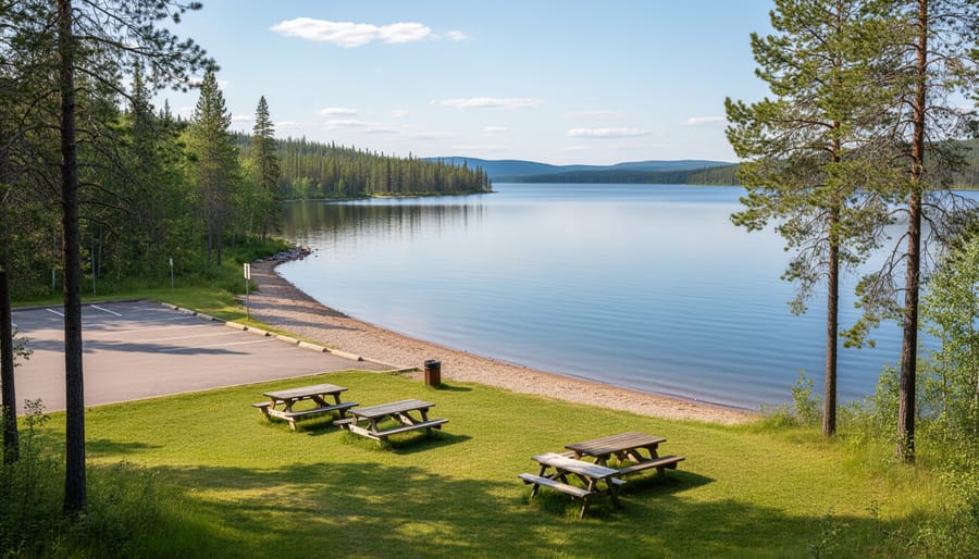
Pine Lake Recreation Area sits just 60 kilometers south of Fort Smith along Highway 5, making it the perfect first stop for families and visitors who want a taste of Wood Buffalo National Park without committing to a full backcountry expedition. The drive takes about 45 minutes on a well-maintained gravel road that’s accessible year-round, though conditions can be dusty in summer and snow-packed in winter.
When you arrive, you’ll find a genuine day-use area with picnic tables scattered under towering spruce trees, vault toilets, and a designated swimming beach on the lake’s sandy shoreline. The water stays surprisingly warm through July and August, drawing local families from Fort Smith for weekend outings. Kids love the shallow entry and the chance to spot painted turtles sunning on logs.
Two short interpretive trails loop from the parking area, one circles the lake in about 30 minutes, while the other cuts through boreal forest where you might encounter red squirrels, whiskey jacks, and the occasional moose browsing near the shoreline. Both trails are well-marked and manageable for younger children.
Pack a cooler and plan to spend a few hours. There’s no cell service and no potable water on-site, so bring everything you need from town. Most Fort Smith locals recommend arriving before noon on summer weekends to claim a good picnic spot.
2. Salt Plains Overlook and Hiking Trail
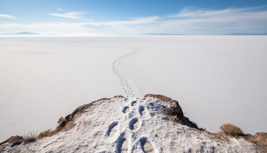
The Salt Plains stretch across 400 square kilometers of blindingly white landscape, one of the most surreal sights you’ll encounter in Wood Buffalo. These vast flats formed when an ancient sea evaporated millions of years ago, leaving behind deposits up to three meters thick. A dedicated overlook gives you the full panoramic view, bring sunglasses, because on sunny days the glare is intense.
The hiking trail descends from the overlook down to the plains themselves, roughly 3 kilometers return. It’s moderate terrain, but the sun exposure is relentless and there’s zero shade, so start early and carry more water than you think you’ll need. Once you’re on the flats, the scale becomes overwhelming, you can walk for what feels like forever across the cracked salt crust.
Wildlife thrives here despite the harsh conditions. Watch for bison tracks pressed into softer areas, and scan the edges for black bears feeding on salt-tolerant plants. Sandhill cranes sometimes wade through seasonal pools where salt concentrations shift.
For photographers, golden hour transforms the plains into something otherworldly. The white expanse catches every colour shift at sunrise and sunset. Plan to stay overnight at Fort Smith lodging if you want to catch both.
3. Peace-Athabasca Delta
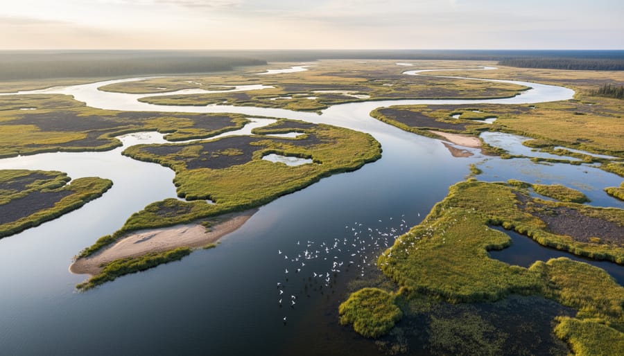
The Peace-Athabasca Delta spans over 3,000 square miles at the confluence of three major rivers, making it the world’s largest boreal inland delta and one of North America’s most important wetland ecosystems. This vast network of channels, shallow lakes, and sedge meadows serves as critical nesting habitat for millions of migratory waterfowl and is the only known nesting site of the endangered whooping crane.
Access to the delta requires either a boat launch from park waterways or a chartered floatplane, as no roads penetrate this remote wilderness. Most visitors arrange fly-in trips from Fort Smith during the brief summer window when water levels stabilize and insect activity becomes manageable. The delta transforms dramatically with the seasons: spring breakup brings massive flooding that replenishes the wetlands, summer offers peak birdwatching with nesting cranes and pelicans, and fall migration sees enormous flocks staging before their southern journey.
Serious birders plan trips between late May and early July for the best chance to observe whooping cranes from a respectful distance, though sightings are never guaranteed in this vast landscape. The delta’s channels also support moose, beavers, and muskrats, with bald eagles and peregrine falcons nesting along the shorelines.
4. Bison Viewing and Backcountry Routes
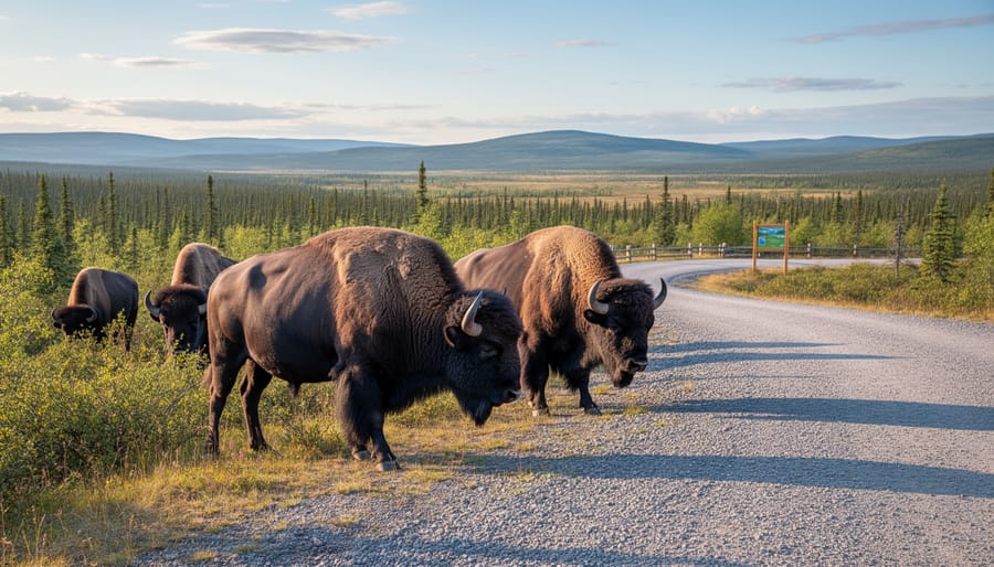
Wood Buffalo National Park protects one of the world’s last free-roaming wood bison populations, numbering around 3,000 animals across the park’s vast landscape. These massive creatures, bulls can weigh up to 900 kilograms, are a conservation success story and a highlight for many visitors.
Your best chance for roadside viewing is along Highway 5 north of Fort Smith, particularly in early morning or late evening when bison move to graze near the road. Drive slowly, keep your windows up, and never approach on foot. Bison appear docile but can charge without warning at speeds exceeding 50 kilometers per hour. Stay in your vehicle and maintain at least 100 meters distance, use binoculars or a telephoto lens to get a closer look.
Backcountry hikers frequently encounter bison near Salt River day-use areas and along the trails to Salt Plains. If you meet bison on foot, back away slowly, never run, and put a large tree or your vehicle between you and the animal if possible. Travel in groups and make noise on trails to avoid surprising them.
Stop at the visitor centre at 149 MacDougal Road before heading out. Staff can tell you where bison have been spotted recently and provide current safety advice for the areas you plan to visit.
5. Sweetgrass Station and Historic Sites
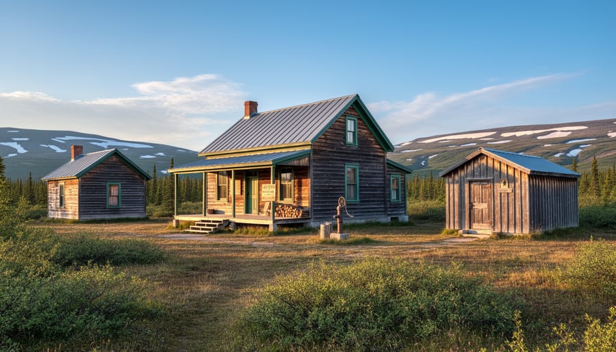
Sweetgrass Station stands as one of Wood Buffalo’s most accessible windows into the park’s layered past. This former ranger outpost, roughly 60 kilometers south of Fort Smith along the park road, served as a critical hub during the early decades of conservation work, a time when protecting the struggling wood bison population required constant vigilance and hands-on management.
Today, the site functions as an interpretive area where you can explore restored buildings and displays that tell the story of those early rangers who lived and worked in extreme isolation. The exhibits cover the establishment of the park in 1922, the challenges of managing such a vast wilderness with limited resources, and the Indigenous peoples, primarily Dene, Cree, and Métis, whose traditional territories the park encompasses and who continue deep cultural connections to this land.
What makes Sweetgrass Station worth the stop is its tangible sense of place. Standing beside the old station buildings, you get a real feel for what frontier conservation looked like: basic structures, long winters, and the determination required to protect a species on the brink. Information panels discuss traditional land use, historic trading routes, and how Indigenous knowledge has shaped modern park management.
The site has basic facilities, vault toilets and picnic tables, making it a good midway break if you’re heading deeper into the park. It’s open year-round and requires no special permit beyond park entry.
6. Karst Landscape and Sinkholes
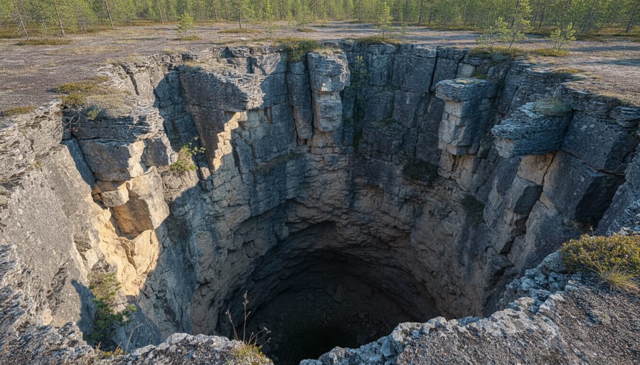
Wood Buffalo’s karst terrain ranks among North America’s most extensive northern karst systems, shaped over millennia by water dissolving the region’s ancient limestone bedrock. The result is a hidden world of sinkholes, underground streams, and collapsing caves that punctuate the boreal forest floor, geological surprises you won’t find in most Canadian national parks.
The most accessible viewing area lies along the road to Pine Lake, where several dramatic sinkholes appear just off the roadside. These collapsed depressions, some 15 meters deep and ringed with spruce, offer safe vantage points to witness karst processes in action. You’ll notice how water vanishes into the forest floor through cracks in exposed limestone, feeding underground rivers that resurface kilometers away.
What makes this landscape remarkable is its northern location. Karst formations typically develop in warmer climates over millions of years, but Wood Buffalo’s features formed in a harsh boreal environment where freeze-thaw cycles accelerated the dissolution process. The limestone here dates back 400 million years to ancient seas, now cracked and pocked by relentless water chemistry.
Before heading out, stop at the Fort Smith Visitor Centre at 149 MacDougal Road for detailed maps showing safe karst viewing locations and areas to avoid, some sinkholes remain unstable and poorly marked.
7. Backcountry Canoe Routes
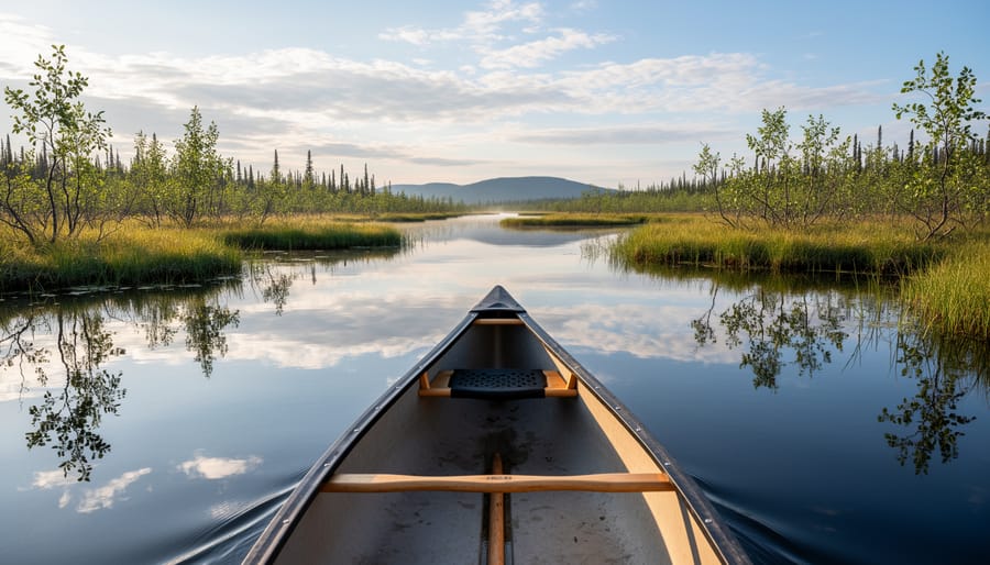
The Peace-Athabasca Delta and the park’s river networks offer some of the most remote paddling in North America, but these aren’t trips for weekend canoeists. Most routes require five to ten days, cover challenging open water crossings, and demand solid backcountry navigation skills. You’ll paddle through landscapes where you might not see another person for days, navigating braided channels where water levels shift dramatically with seasonal flooding.
Before you even think about launching, you need a backcountry camping permit from Parks Canada. Stop at the visitor centre at 149 MacDougal Road to discuss your planned route with staff who know current water levels, recent wildlife activity, and which channels are passable. They’ll also help you understand the permit process and any area restrictions, including closures related to the 2023 fires.
If you’re drawn to these waters but lack the experience for a solo expedition, several Fort Smith-based outfitters offer guided canoe trips ranging from three-day introductions to week-long deep wilderness journeys. They provide everything from canoes and camping gear to satellite communication devices and wildlife safety training. Even experienced paddlers often hire local guides for their first trip, the delta’s complexity and remoteness make local knowledge invaluable. Ask at the visitor centre for current outfitter recommendations and rental options if you’re planning a self-guided journey.
Getting to Wood Buffalo National Park: Roads, Routes, and Current Conditions
Year-Round Road Access from Fort Smith
Fort Smith sits directly on Highway 5, which continues north into the park as the primary access route. This all-season gravel highway connects you to Pine Lake Recreation Area in about 60 kilometers, roughly 45 minutes of driving under normal conditions. The road surface is maintained year-round but remains gravel throughout, so expect dust in summer and occasional washboard sections that slow your pace.
You won’t find fuel stations once you leave town, so fill up in Fort Smith before heading out. The nearest services beyond the park boundary are hours away in either direction. Winter driving requires extra caution, pack emergency supplies, tell someone your route, and check road reports at the visitor centre before departure. The park’s main office at 149 MacDougal Road can provide current road conditions and any weather advisories that might affect your drive.
Most visitors stick to the Pine Lake area for day trips, but backcountry destinations like the Salt Plains or Sweetgrass Station add significant drive time on rougher secondary roads that demand high clearance and patience.
Current Park Gate Hours and Closures
Wood Buffalo National Park maintains year-round road access from Fort Smith, but checking current conditions before you head out is essential. Unlike many national parks, Wood Buffalo doesn’t have staffed entrance gates with posted hours, you can enter the park at any time. However, some areas remain off-limits due to closures from 2023 fires that left hazards like unstable trees and damaged trail infrastructure.
The most reliable way to get current closure information is to stop at the visitor centre at 149 MacDougal Road before entering the park. Staff can tell you which trails and areas are safe to visit and which remain closed for public safety. They’ll also update you on road conditions, recent wildlife activity, and any new temporary closures you need to know about.
Parks Canada posts closures online, but conditions can change quickly in the backcountry. If you’re planning a specific destination or backcountry route, calling ahead to confirm access can save you a wasted trip into the park.
Local Tips for Visiting Wood Buffalo National Park
Best Times to Visit and What to Expect
Summer brings nearly 24-hour daylight from June through July, perfect for extended wildlife viewing and photography, but pack serious bug protection, mosquitoes and blackflies are relentless. The long days also mean you can explore more in a single trip, though you’ll want to time outdoor activities for early morning or evening when insects are slightly less aggressive.
Fall, from late August through September, offers the park at its finest. Insects die off after the first frost, wildlife becomes more active as animals prepare for winter, and the boreal forest explodes in gold and crimson. This is prime time for spotting bison herds and migratory birds without the summer crowds. Book your where to stay arrangements early, as fall is increasingly popular.
Winter transforms the park into an extreme environment, temperatures regularly drop below -40°C, but you’re rewarded with spectacular northern lights displays and a stark, pristine landscape. Only experienced cold-weather travelers should attempt winter visits, and you’ll need specialized gear and a reliable vehicle.
Spring flooding from April through early June makes many areas inaccessible as the Peace-Athabasca Delta swells with meltwater, but this is when millions of migratory birds arrive to nest, including the endangered whooping cranes the park protects.
What to Stock Up on in Fort Smith
Fort Smith is your last reliable supply stop before entering the park, and it’s a critical one. The town has grocery stores, gas stations, and outdoor outfitters where you should stock up on everything you’ll need, because once you’re in Wood Buffalo, there are no services, no fuel pumps, and no corner stores for hundreds of kilometers.
Fill your tank completely and consider bringing extra fuel if you’re planning extended backcountry exploration. Load up on groceries for the duration of your stay, plus a buffer day or two in case weather or wildlife delays your plans. Bug spray is essential from May through August, locals swear by high-DEET formulas and head nets during peak mosquito season. Bear spray is non-negotiable for anyone venturing onto hiking trails or backcountry routes; you can purchase it at local outdoor shops if you’re flying in and couldn’t bring it on the plane.
Stop by the visitor centre at 149 MacDougal Road to top up water bottles at their fill-up station and ask staff about current conditions that might affect your supply needs.
Frequently Asked Questions
Do I need a park pass?
Yes, Wood Buffalo National Park requires a valid Parks Canada pass for entry. You can purchase daily or annual passes at the Fort Smith Visitor Centre at 149 MacDougal Road before heading into the park. Staff there can explain which pass works best for your visit length and answer questions about what’s included.
Where can I camp in the park?
Pine Lake offers the most accessible camping from Fort Smith with both frontcountry sites and day-use facilities. Backcountry camping is permitted throughout most of the park with proper registration, though you’ll need to check current area closures at the visitor centre, fire-related closures from 2023 remain in effect in some zones due to ongoing hazards. Stop at 149 MacDougal Road to register for backcountry trips and get the latest conditions.
Is the park accessible in winter?
Fort Smith provides year-round road access to Wood Buffalo National Park, making it one of the few northern parks you can reach by vehicle even in the coldest months. Winter visits require serious cold-weather preparation, temperatures can drop below -40°C, but reward you with potential northern lights viewing, pristine snow landscapes, and minimal crowds. Check road conditions and gate status at the visitor centre before winter trips.
How far is the park from Fort Smith?
The park boundary begins just outside Fort Smith, with Pine Lake Recreation Area about a 60-kilometer drive from town, the closest developed area for most visitors. The visitor centre at 149 MacDougal Road is your first stop for maps, current distances to specific areas, and road condition updates before you head out.
What wildlife might I see?
Wood bison are the park’s iconic species and you have good chances of roadside sightings, especially near Salt Plains and backcountry areas. Black bears, moose, wolves, and over 200 bird species including the endangered whooping crane also call the park home. Always maintain safe distances and ask Fort Smith locals at the visitor centre about recent wildlife activity before your visit.
Can I visit without a 4×4?
Yes, regular vehicles can access Pine Lake and other main areas via maintained gravel roads during summer months. Backcountry routes and spring conditions may require higher clearance, so check current road status at the Fort Smith Visitor Centre when you pick up your park pass.
Stock up on fuel, food, and emergency supplies in Fort Smith before entering, resupply options inside the park are essentially nonexistent. The visitor centre staff can give you a realistic checklist based on where you’re heading and how long you plan to stay.